
Rivanna Water & Sewer Authority (RWSA) is committed to responsibly managing our region’s water resources to ensure a reliable supply of drinking water. Our Drought Response and Contingency Plan guides how we monitor changing water supply conditions, evaluate drought severity, and determine when drought stages should be declared. This webpage provides a summary of the plan. Once a drought stage is declared, the Albemarle County Service Authority, the City of Charlottesville, and Albemarle County can implement the corresponding water-use restrictions.
Current Reservoir Status
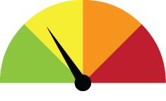
Drought Watch
Last Updated: August 24, 2026
View the full weekly water report, which includes our reservoir levels, precipitation amounts, and production totals for the previous week.
South Fork Rivanna Reservoir
(% full)
100%
Beaver Creek Reservoir
(% full)
88.50%
Probability-Based Forecast Model*
Report ran July 10, 2026
54%
*Statistical chance that the South Fork Rivanna Reservoir’s water levels will fall to 80% of total capacity within 12 weeks of the report having been run.
RWSA's Drought Monitoring Program
A Drought Watch was declared on Tuesday, July 14.
Drought conditions are being monitored by the Rivanna Regional Drought Response Committee. The committee is comprised of staff from Charlottesville Utilities Department, the Albemarle County Service Authority, Albemarle County, and RWSA. They work together to coordinate responses, including enforcing conservation measures if conditions worsen.
The City of Charlottesville, Albemarle County, and Albemarle County Service Authority are responsible for enacting and enforcing water conservation measures under their respective codes, ordinances, and regulations.
Rivanna Water & Sewer Authority manages five reservoirs; our staff continually monitor the reservoirs to provide data to the committee.
The Drought Response and Contingency Plan categorizes drought declarations into three stages: Watch, Warning, and Emergency. Each stage has specific triggers and prompted conservation measures that intensify as the stages progress (please refer to the RWSA Drought Stages sidebar on this webpage for more details).
A drought stage declaration can be made when one of these internal triggers is reached. Alternatively, the Authority has the option to declare a drought stage if one of the following external conditions occurs:
- Virginia’s Drought Monitoring Task Force issues a Watch, Warning, or Emergency for the Middle James region (more on this below).
- The Governor of Virginia declares a Drought Emergency.
- The Virginia Drought Coordinator declares a Drought Emergency for the area.
- There is a significant disruption in the community’s water reserves.
Please note that this is not an all-inclusive list. Additional items may be considered and are included in our full Drought Response and Contingency Plan.
Operational Changes
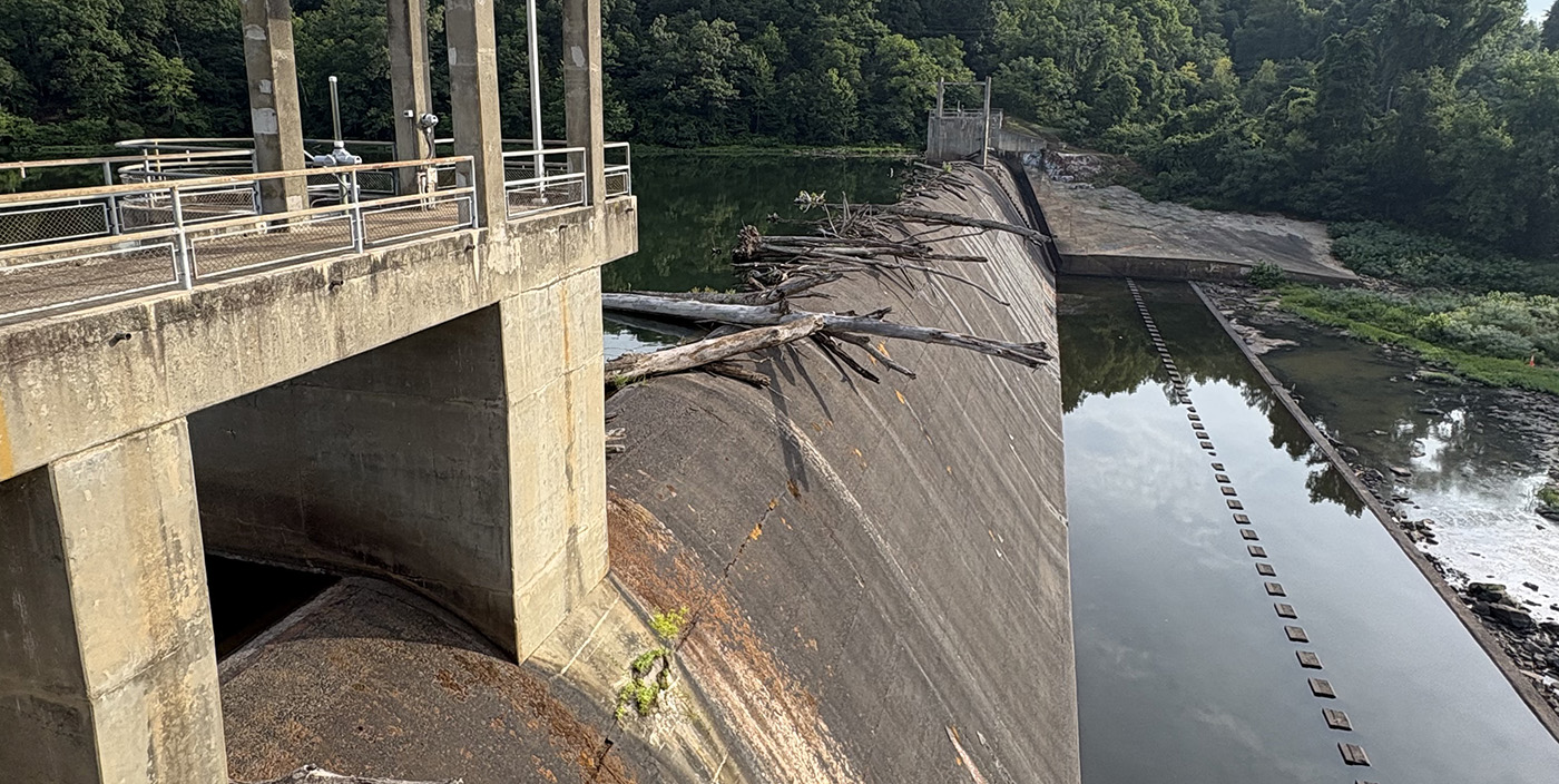
During normal operations, Rivanna Water & Sewer Authority primarily draws water from the South Fork Rivanna Reservoir to meet urban water demands. The reservoir generally has surplus water, and large withdrawal rates typically do not affect its pool level. When water stops flowing over the dam, the strategy changes, and RWSA begins to draw more water from the Ragged Mountain Reservoir to safeguard the reserves at the South Fork Rivanna Reservoir.
A dam that stops spilling usually indicates that the water consumption, evaporation, and required downstream releases exceed the reservoir’s natural ability to replenish itself. The ability to shift production between water treatment plants allows RWSA to balance the consumption of the community’s water reserves.
Current infrastructure projects, such as the Ragged Mountain Pool Fill Project, South Fork Rivanna Reservoir to Ragged Mountain Reservoir Raw Water Line Project, and the Central Water Line Project, will increase water supply and provide RWSA with greater operational flexibility in the future, making the community even more resilient to droughts.
Differentiating Between National, State, & Local Drought Declarations
Well-known drought monitors are classified into three tiers: National, State, and Local.
U.S. Drought Monitor
The U.S. Drought Monitor is produced jointly by the National Drought Mitigation Center at the University of Nebraska-Lincoln, the National Oceanic and Atmospheric Administration and the U.S. Department of Agriculture. The U.S. Drought Monitor is not a forecast; it looks back in time, providing a “snapshot” of very recent conditions. You can view the most recent national map here.
The Virginia Department of Environmental Quality’s Drought Monitoring Task Force
The Virginia Department of Environmental Quality divides the Commonwealth into thirteen monitoring regions to assess drought conditions. Our community resides in the Middle James Region, which extends from Amherst County in the west to Henrico County in the east, and from Albemarle County in the north to Prince Edward County in the south. This region includes Albemarle, Nelson, Amherst, Appomattox, Prince Edward, Amelia, Chesterfield, Henrico, Hanover, Goochland, Cumberland, Buckingham, and Fluvanna counties. Each region is evaluated using four key indicators: precipitation, groundwater levels, streamflow, and reservoir levels. Drought stage declarations are based on data from the entire region and may not always accurately reflect RWSA’s local conditions. You can view the most recent state map here.
Rivanna Local Drought Response
As covered in greater detail above, RWSA monitors local water supply conditions by focusing on reservoir storage levels and using a probability-based forecast model to declare local droughts. One of the primary measures RWSA tracks is whether its reservoirs are spilling, meaning water is flowing over the dam. When reservoirs are no longer spilling, RWSA closely monitors available water storage to assess current reserves and evaluate the local water supply outlook.
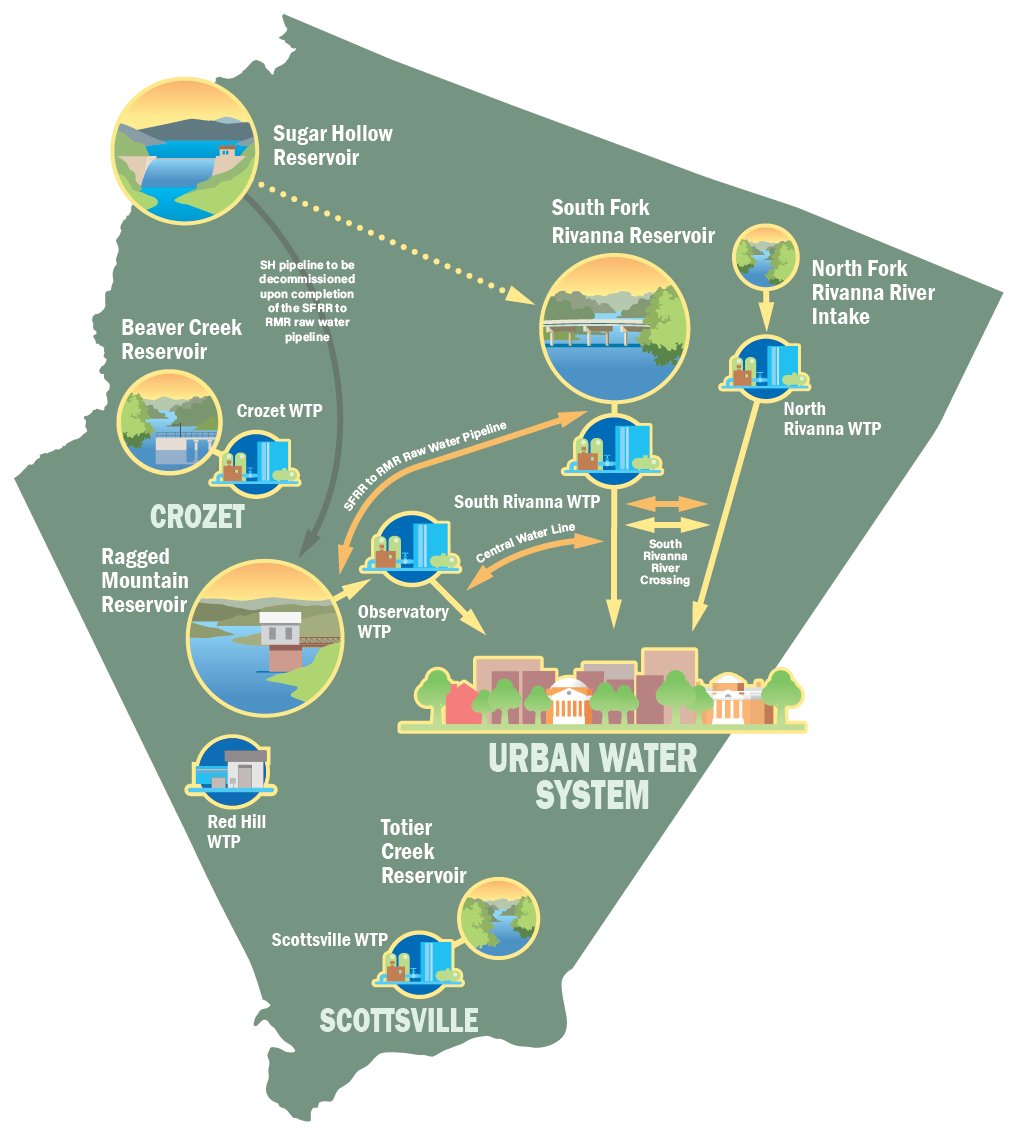
The City of Charlottesville and the surrounding urban area receive drinking water from three reservoirs and one river. Sugar Hollow Reservoir, located west of White Hall in the Blue Ridge Mountains, stores approximately 324 million gallons of water. Ragged Mountain Reservoir, located just northwest of the Interstate 64 and U.S. Route 29 interchange, is the region’s largest water supply reservoir, with a storage capacity of just over 1.4 billion gallons. South Fork Rivanna Reservoir, located west of Walmart, holds approximately 885 million gallons of water. As the most visible reservoir to the public, it can be seen when traveling on Earlysville Road, Berkmar Drive, and U.S. Route 29. In addition to these reservoirs, RWSA also withdraws water from the North Fork Rivanna River to supplement the area’s water supply.
Beyond the Urban Water System, RWSA also monitors the Crozet water system, specifically the Beaver Creek Reservoir. Located west of Charlottesville, Beaver Creek Reservoir stores approximately 521 million gallons of water and serves as the primary drinking water source for the Crozet area.
RWSA Drought Stages
RWSA has three drought stages:
Watch
Warning
Emergency
Localized metrics determine which drought stage the region is in. When a drought stage is declared, predetermined water-use restrictions are implemented in accordance with local regulations.
Drought Watch
Triggers
- 90.2% usable storage or less at the South Fork Rivanna Reservoir
- 60% usable storage or less at the Beaver Creek Reservoir
- 20% chance or more that the South Fork Rivanna Reservoir's usable storage will fall to 80% within the next 12 weeks.
Watch Restrictions
- Watering of vegetation is limited to what is necessary to protect plant life and, if required, should occur between 9 PM and 10 AM.
Drought Warning
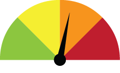
Triggers
- 80.8% usable storage or less at the South Fork Rivanna Reservoir
- 50% usable storage or less at the Beaver Creek Reservoir
- 10% chance or more that the South Fork Rivanna Reservoir's usable storage will fall to 70% within the next 10 weeks.
Warning Restrictions
- Mandatory conservation efforts are implemented
- Watering of vegetation is limited to what is necessary to protect plant life.
- Watering should occur between 9 PM and 10 AM.
- Vehicle washing is limited to commercial vehicle washes.
- Exterior washing of outdoor surfaces is prohibited unless required by federal, state, or local law.
- The operation of any ornamental fountain or similar is prohibited.
- Filling and topping of swimming pools is prohibited unless written approval is provided by ACSA/Director of Utilities.
- Fire hydrant use is restricted to fire suppression.
- Water may be served in restaurants only upon request by the patron. *Please note that this is not an all-inclusive list. Additional items may be considered and are included in our full Drought Response and Contingency Plan.
Drought Emergency
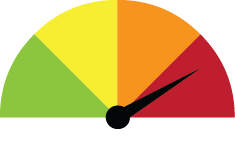
Triggers
- 63.3% usable storage or less at the South Fork Rivanna Reservoir
- 40% usable storage or less at the Beaver Creek Reservoir
- 5% chance or more that the South Fork Rivanna Reservoir's usable storage will fall to 60% within the next 8 weeks.
Emergency Restrictions
- Previously granted exemptions are nullified.
- All outdoor watering is prohibited.
- Businesses, institutions, and governmental entities shall develop a written plan to reduce their water use by 20%. The plan shall be implemented within 14 days of a Drought Emergency notice.
- Known water leaks must be repaired within three business days after receiving notification from ACSA/Charlottesville Department of Utilities.
If conditions worsen and additional measures are needed, the following restrictions may be enacted:
- Restrict or discontinue the supply of water to industrial or commercial activity that uses water beyond the sanitary and drinking needs of its employees and invitees
- Declare a moratorium on new water connections. *Please note that this is not an all-inclusive list. Additional items may be considered and are included in our full Drought Response and Contingency Plan.